
There's been a lot of buzz around the internet about a potential arctic blast hitting Texas the week of Jan. 14th. And while it's true that long-range models are showing temperatures falling into the low-teens and even single-digits, this doesn't necessarily guarantee that temperatures will tumble in our region. What we can count on, however, is the fact that someone, somewhere in the Northern Hemisphere will likely experience temperatures well below normal; it just may not end up being us.
The reason for this chatter is a somewhat infrequent phenomenon known as Sudden Stratospheric Warming (SSW) which has recently been observed over the poles. SSW is basically when the stratosphere, a region of our atmosphere located between about 4 and 18 miles up in winter, warms by an absurdly high amount.
A good example of a recent warming event occurred about 3 years ago to today, in early January of 2021. Temperatures above the Arctic Circle warmed by about 55 F in as little as one week. Now despite this warming, temperatures were still very cold (around -30 F), but such an abrupt change in temperature had a significant effect on the global weather pattern that eventually led to the infamous deep freeze that killed 246 Texans about a month later in Feb. 2021.
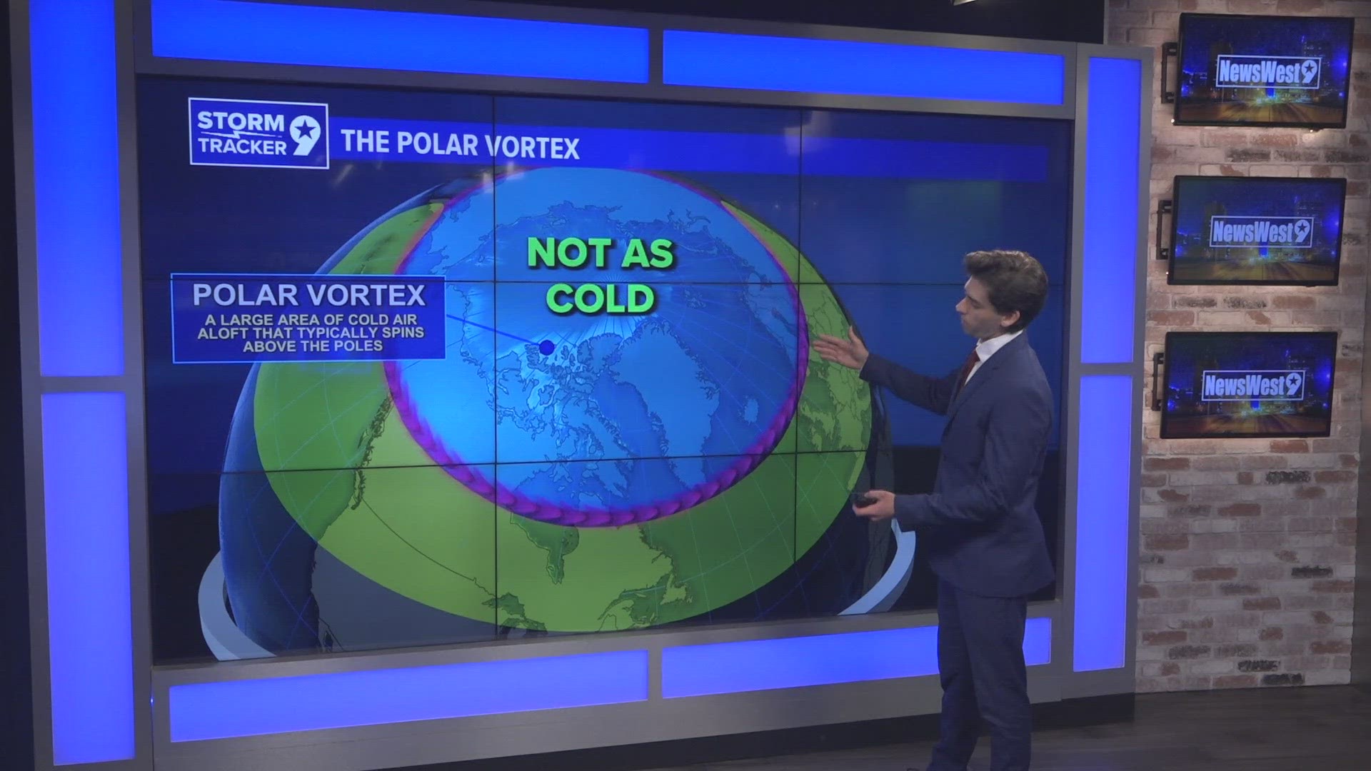
The interactions leading to this effect are complex, but I'll go ahead and break it down for you. Essentially, stratospheric warming over the Arctic weakens the winds, known as the polar jet stream, circulating around the coldest air in the Northern Hemisphere known as the Polar Vortex.

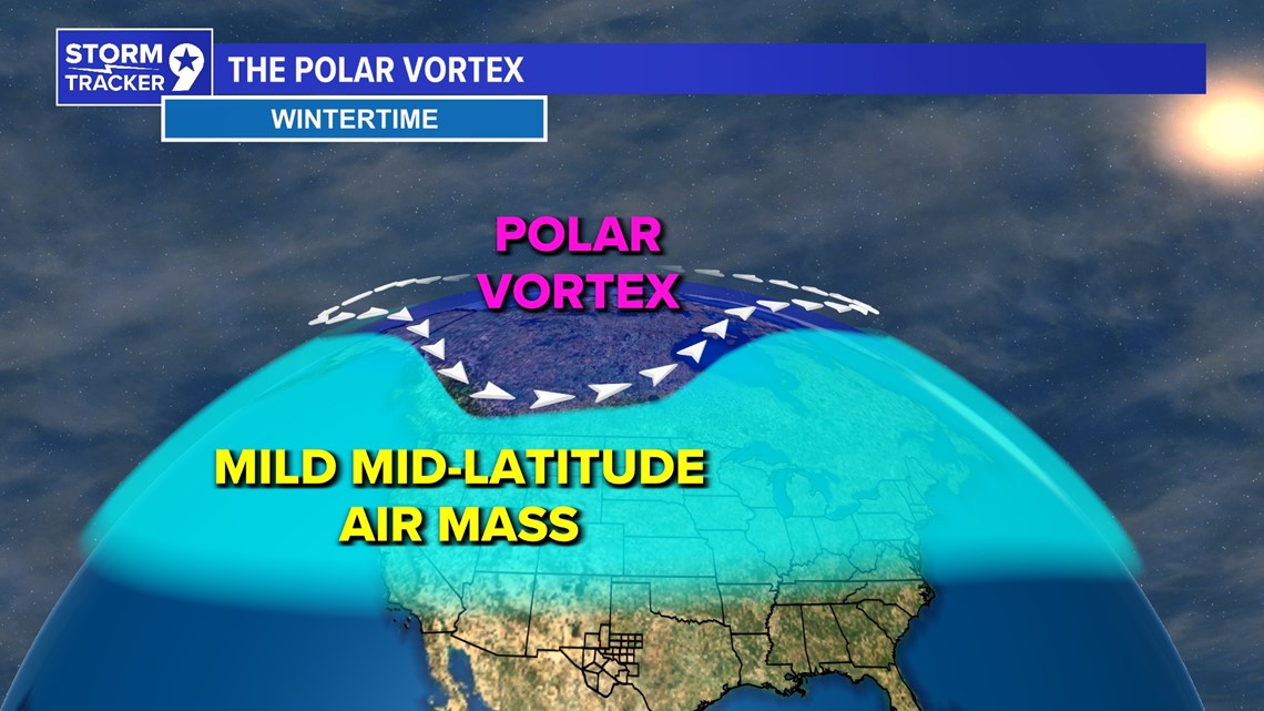
The polar jet stream flows from west to east and is in charge of keeping this bitterly cold air locked up, close to the North Pole. One interesting facet about the winds in the jet stream is that their strength depends on how large the temperature gradient is between the arctic region and the lower latitudes. So, when air over the arctic warms up and the air further south stays the same, the temperature difference/gradient weakens and thus, the polar jet decreases in strength.
As the polar jet stream weakens, it loses its ability to keep arctic air confined to the Arctic Circle, where it belongs. In turn, this air ends up spilling over into Eurasia or North America which is exactly what happened to Texas in February of 2021. It typically takes about 4 weeks for an arctic invasion to occur after the onset of sudden stratospheric warming.
Model runs from this fall have hinted at SSW ensuing in mid to late-December and this is exactly what has happened. Just as predicted, the stratosphere warmed by about 15-20 degrees over the Arctic Circle. Although this isn't as big a jump as in 2021, we could still see temperatures just as cold. Right now, medium to long range models are predicting an arctic front moving in mid-January.
It's possible that we could see temperatures fall to the low teens or even colder here in West Texas. It's also possible that this cold snap misses us and instead affects the east coast. It's even possible that the cold air misses North America entirely and instead affects Europe or Asia. What is pretty certain, however, is that somebody is going to get hit with an extremely cold airmass, it just may not end up being us. Recent models runs are, however, starting to favor this air mass getting closer to us.