
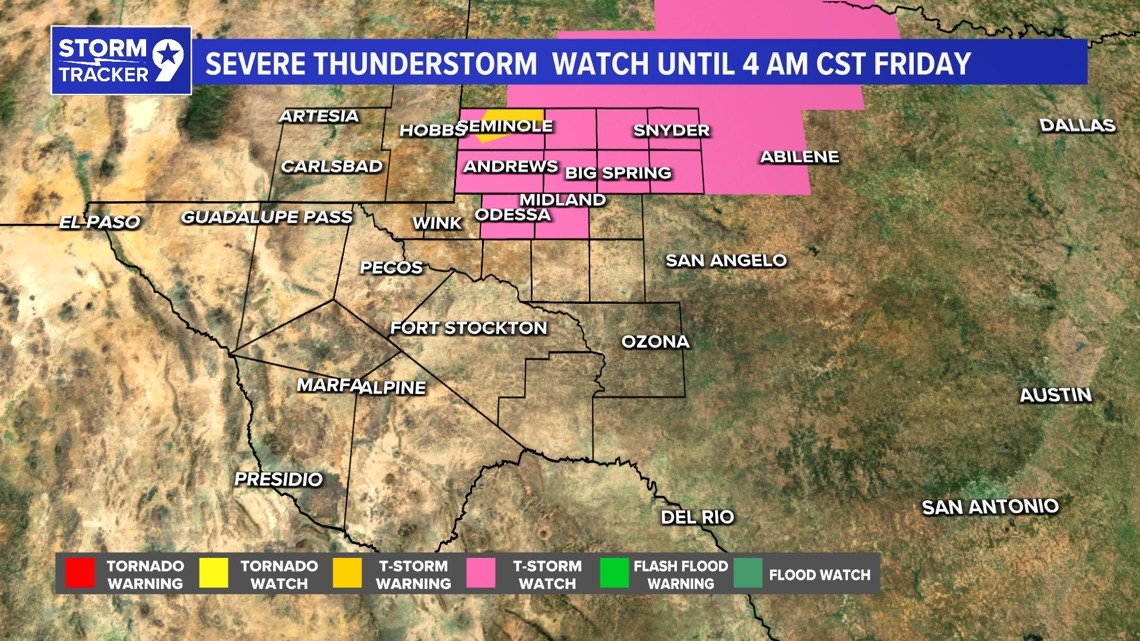
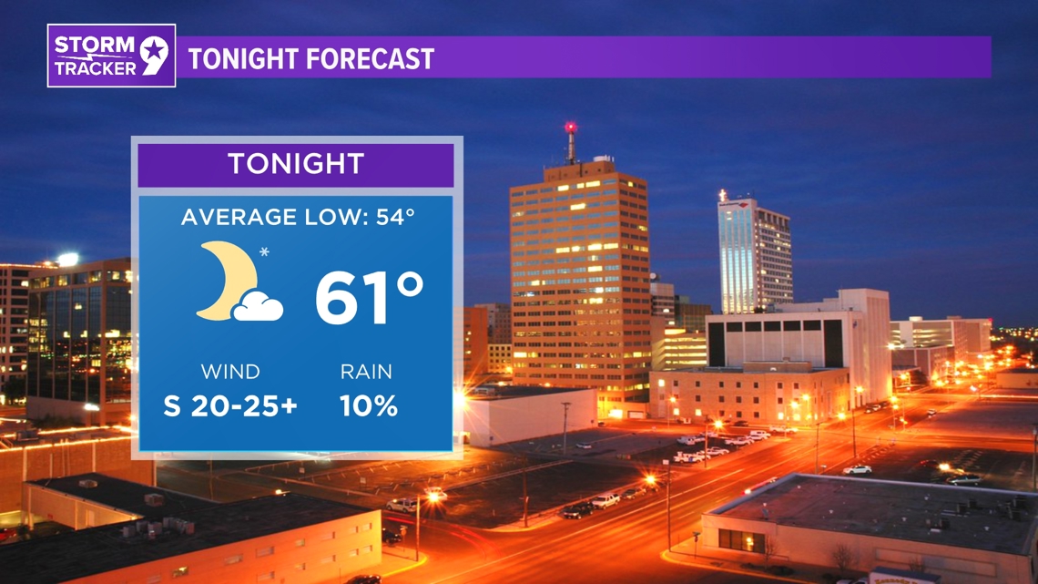
TONIGHT: Another round of potential thunderstorms looks to pop up along the dryline tonight. While the SPC has us under a level 2 risk, the NWS has the area under a low chance for severe weather. Most of the region will just see plenty of cloud cover and warm nightly temperatures due to the stronger southerly winds.
LOW: 61°
WIND: S 20-25+ mph.

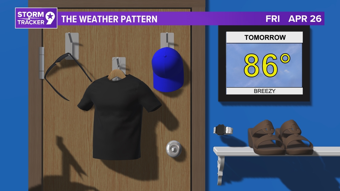
TOMORROW: The dryline giving the atmosphere the spark it needs to create thunderstorms will be moving out to the east towards Central Texas, leaving us with mostly sunny skies and above average temperatures. Westerly winds take over at that point and we may be subject to some localized blowing dust on top of the increased fire risk due to the low humidity, warm temperatures and strong wind gusts.
HIGH: 86°
WIND: W 20-25+ mph.

IN COMING DAYS: The long-term forecast predicts a mix of challenges and potential relief. Friday night into Saturday, high winds are expected over West Texas and Southeast New Mexico, exacerbating critical fire weather conditions. In the east, some convection is possible before the dryline moves eastward. Despite a Pacific front, Saturday's temperatures should remain around normal, with wind warnings likely for parts of the area. Sunday sees a slight temperature drop, making it the coolest day of the forecast. Temperatures recover Monday and Tuesday, with a chance of convection increasing Tuesday night into Wednesday as an upper trough approaches. We will keep you updated with the latest as the new model data comes in regard to next week's chances for rain.


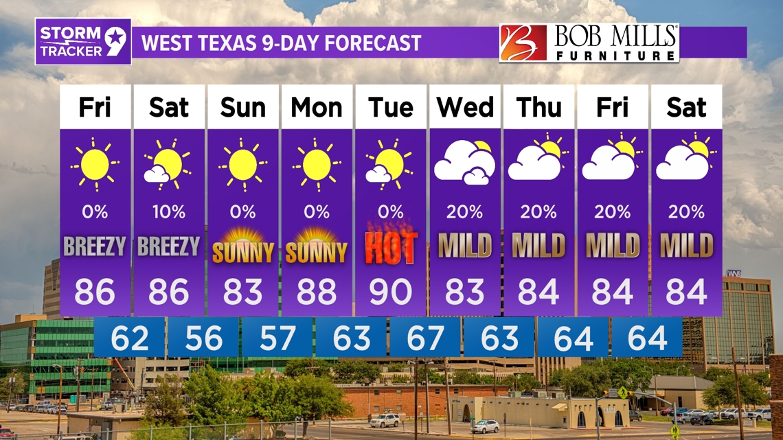
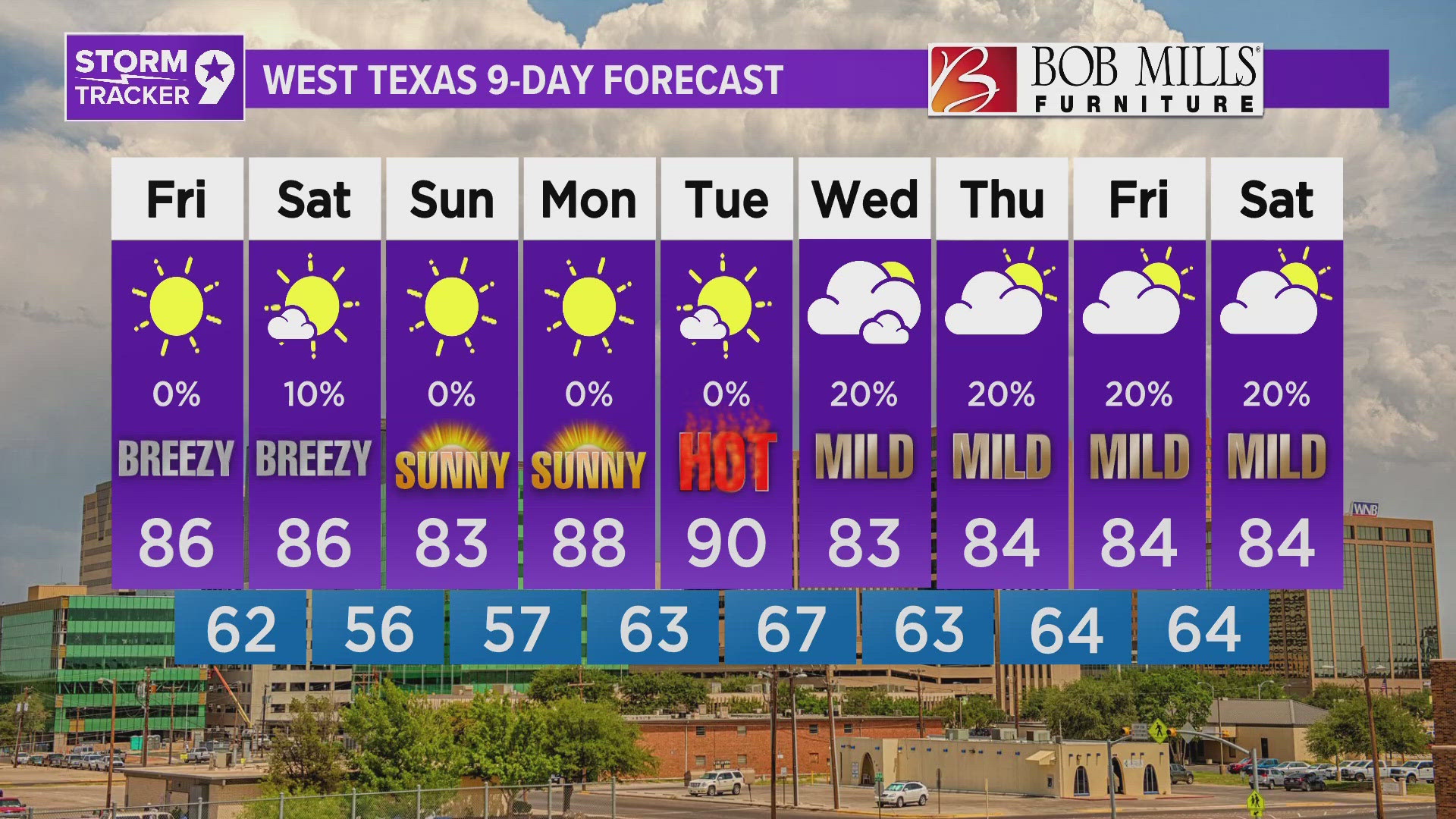
Saturday: 10% chance for showers and mostly sunny with highs near 86°.
Sunday: Sunny with highs near 83°.
Monday: Sunny with highs near 88°.
Tuesday: Mostly sunny with highs near 90°.
Wednesday: 20% chance for showers and mostly cloudy with highs near 83°.
Thursday: 20% chance for showers and partly cloudy with highs near 84°.
Friday: 20% chance for showers and partly cloudy with highs near 84°.
Saturday: 20% chance for showers and partly cloudy with highs near 84°.