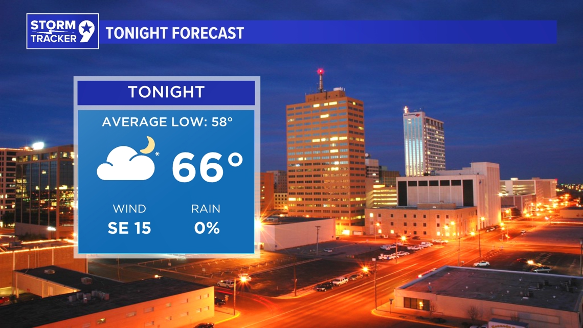
TONIGHT: Today is notably calmer compared to yesterday, with a cooler and more stable air mass behind the recent cold front, resulting in temperatures in the 60s and 70s. The region is experiencing a low cloud deck, offering pleasant conditions for early May. While most of the rain has moved out, some scattered showers might develop later in the afternoon, particularly in the Davis Mountains according to a few high-resolution models.
LOW: 66°
WIND: SE 15 mph.

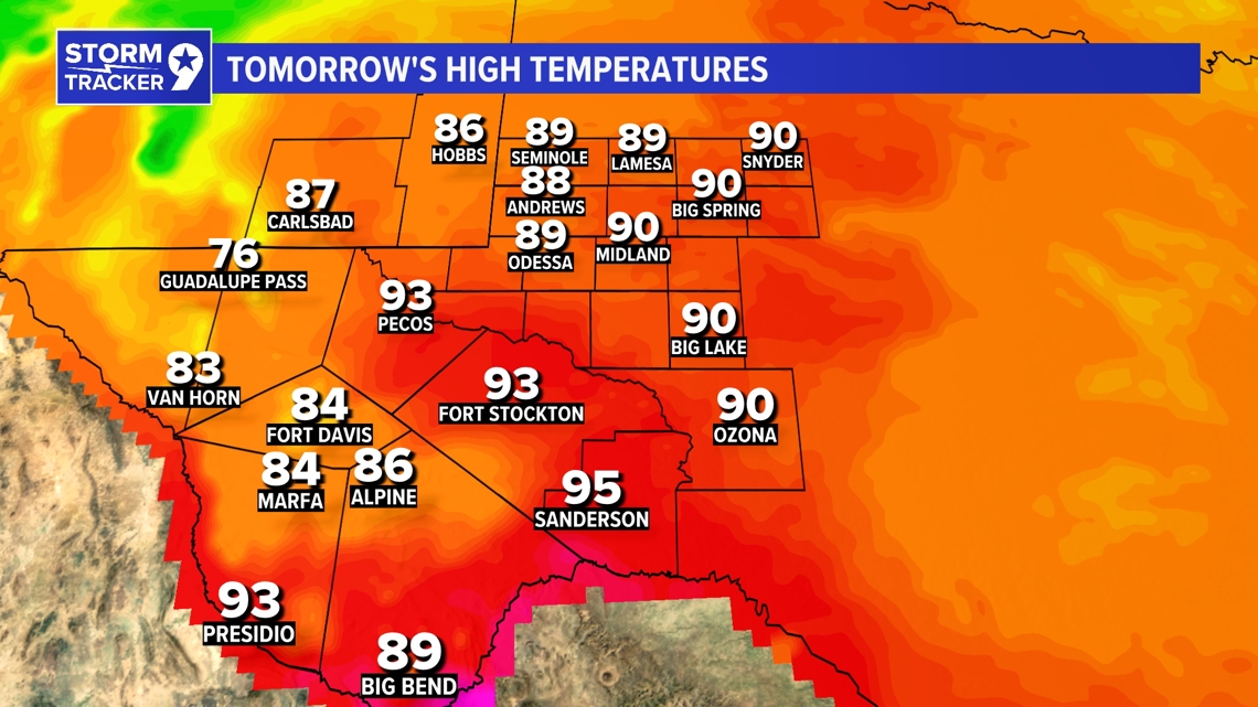
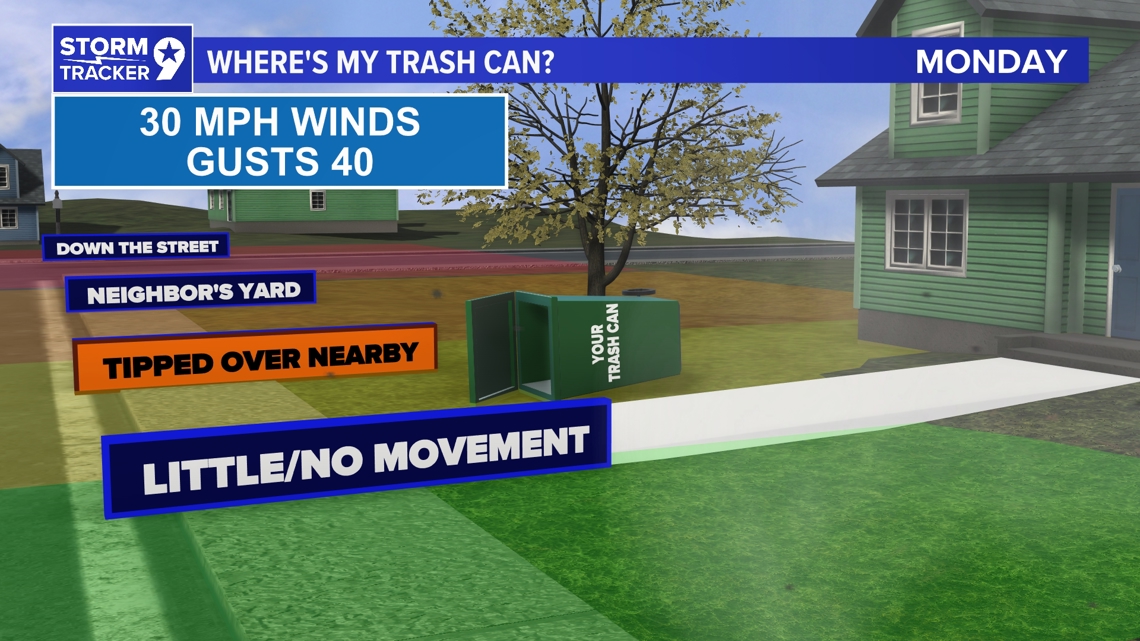
TOMORROW: Looking ahead to Monday, an upper trough swiftly moves from the western U.S. into the Great Plains, causing winds to shift from the southwest to the west. This change will push clouds eastward and bring in more typical temperatures, with highs ranging from the 80s to 90s. However, drier air moving in from the west should prevent any chance of rain.
HIGH: 90°
WIND: W 20-25+ mph.

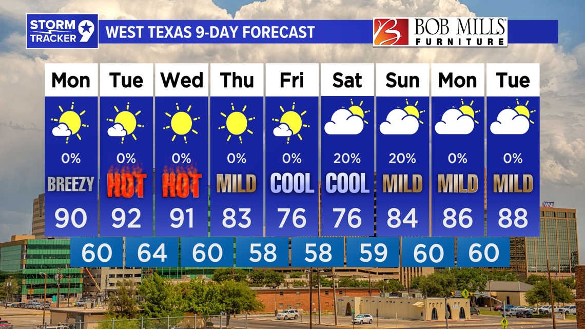
IN COMING DAYS: The extended forecast period begins with a relatively calm synoptic pattern, as a potent trough transitions into an upper-low over the northern Great Plains, keeping the southern Great Plains under zonal flow through Tuesday and Wednesday. This leads to hot temperatures, mainly in the 90s, with some areas seeing temperatures in the 100s, particularly in the Big Bend region. However, this heat is expected to be short-lived. By late Wednesday into Thursday, the upper low merges with another trough entering the Pacific Northwest. As a result, a cold front is pushed through the area, causing temperatures to drop several degrees across the northern regions on Thursday, with the rest of the region cooling off by Friday. This transition brings back southwesterly flow aloft and the return of lee troughing, gradually warming temperatures and increasing moisture by next weekend. Weak disturbances associated with the upper-low may bring isolated to scattered thunderstorm threats to some areas, marking the next opportunity for rain after the active weekend.

Tuesday: Mostly sunny with highs near 92°.
Wednesday: Sunny with highs near 91°.
Thursday: Sunny with highs near 83°.
Friday: Mostly sunny with highs near 76°.
Saturday: 20% chance for showers and partly cloudy with highs near 76°.
Sunday: 20% chance for showers and partly cloudy with highs near 84°.
Monday: Partly cloudy with highs near 86°.
Tuesday: Partly cloudy with highs near 88°.