
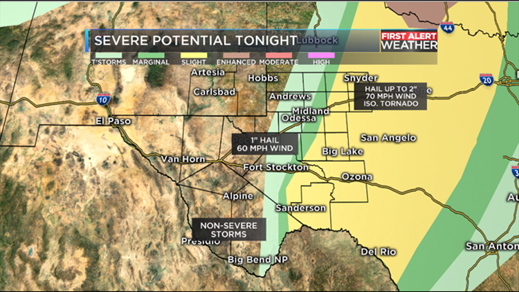
(KWES) - Wednesday is a First Alert Weather Day due to the threat of isolated severe storms in our eastern counties. Rain showers and weak storms may try to form back near the Davis Mountains this afternoon. Storms could produce dry lightning which could make the fire risk worse for that area. Later this evening, storms are expected to initiate near Big Bend National Park and then move northeast. As storms move into our eastern counties, they should increase in intensity. The main cities of concern will be east of a line from Big Spring down to Sanderson. The main threats will be the potential for large hail up to 2" in diameter, wind gusts up to 70 mph, and an isolated tornado.
Counties just to the west of that line could also experience a severe storm or two but the threats/chance will not be as high. Hail up to 1" in diameter and up to 60 mph wind gusts will be possible. Stay with the First Alert Weather Team for all the latest.
Download the First Alert Weather App and it will alert you if there is a severe storm in your area.
Photo Explanation:
- Light green: Non-Severe storms
- Dark Green: Marginally severe storms (1" hail and 60 mph wind gusts)
- Yellow: Slight risk of severe storms (1-2" hail, 60-70 mph wind gusts, isolated tornado)