
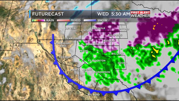
(KWES) - Wednesday is a First Alert Weather Day due to the threat of freezing rain.
A strong cold front is currently rolling through West Texas and will continue to move southwest as we head into early Wednesday morning.
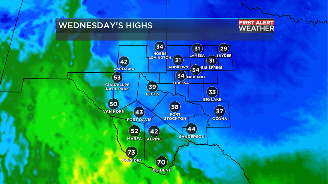
This front will bring in much cooler temperatures with some areas only seeing highs in the 30's.
We may also have enough moisture to give us a chance for some light rain showers. These showers will mainly favor the eastern half of the viewing area because that's where most of the moisture will be.
When temperatures drop below freezing, we could see some of the light rain change over to more of a freezing rain. The first freezing rain to hit the pavement will melt because Tuesday's high temperatures were in the 70's.
If freezing rain continues for a few hours, we could start to see some icing on bridges, overpasses and power lines. We may also see some slick spots on roadways.
Before you head out Wednesday morning, make sure you check to see if ice has formed on any surfaces. If it formed there, it could form on parts of roads.
For the latest weather updates, download the First Alert Weather App by clicking here.